In The Beginning ...

... there were healthy feet. This blog will track my journey to Africa, Australia and New Zealand - the fulfillment of a childhood dream of climbing Kilimanjaro, and the experience of a dream adventure: making safari and exploring a bit of our world.

Monday, December 10, 2007

Franz Joseph

Rain.

The west coast of New Zealand, locally referred to as the "wet coast," receives an average of 113 inches of rain per year. Compare that to the Pacific Northwest, which has the greatest rainfall in the United States, and averages less than 30 inches a year (http://www.cpc.noaa.gov/products/global_monitoring/precipitation/northwest_90prec.shtml).

When it rains, here, it rains moderately hard but almost continuously for days. For example, it has rained for at least 48 hours and looks to stay rainy for another 48. Maybe I won't climb onto the Fox Glacier, either.

Which gives it away that I didn't hike onto the Franz Joseph Glacier. It did not seem worth the cost when I wouldn't see the mountains or the sunlight through the ice. It is challenging to take pictures in a rainstorm, but I took a guided tour that went up to the glacier and shot the following sequence of photos. I have some video clips, as well, which captured the sound of the outflowing river. This river grew in ferocity as the rain continued.

The waterfalls off the surrounding hills were large when we walked in and positively huge when we walked out. We crossed streams that were not there 2 hours before and got soaking wet from the knees down. If the hostel had an oven, I could dry my boots out. As it is, I have lots of wet clothes to pack, since I had to run between the lodging building and the kitchen/lounge building and otherwise got caught in one of the larger downpours when I was grocery shopping without my rain pants. Smart.

The rain is warm, however, and it is very weird to go hiking near a glacier in a warm rain. The outflow from the glacier was shouting as we approached and positively roaring on our return. Large chunks of ice floated by until they met boulders, and the water popped and thumped as it flowed into hollows around these mini-dams.

There are over 3100 glaciers in New Zealand, larger than a hectare (almost 108,000 square feet) (http://www.teara.govt.nz/TheBush/Landscapes/GlaciersAndGlaciation/1/en). Only Mt. Ruapehu on the North Island has glaciers, numbering 18. All the rest are on the South Island.

The Franz Joseph Glacier is quite steep, requiring steps to be cut into the ice in order to climb the face. That's because the glacier is flowing over some large hills, which are too large to be "bulldozed" forward. The Fox Glacier is much less steep, and therefore easier to climb. (It's also supposed to be less crowded - there are over 50 people at a time climbing the Franz Joseph, more later in the summer.)


First glimpse.


Ice in the river.


We did not linger here for more than 30 minutes. The guide knew that the waterfall was creating a lake behind the wall of rock and mud from a previous glacial advancement. When the water got high enough, it would either flow over this wall or collapse it completely due to the weight of its volume. Not the place to be, as the rocks in the near foreground came off the face mid-background and on the right - from just such a water build-up. This guide hikes this area daily, so knows whereof he speaks.


Also, the very right edge of the glacier is due to collapse.


See the hikers on the glacier?


How about now?


Now?


Saturday, December 8, 2007

The Abel Tasman Track and the road to Franz Joseph

I'm going to try putting most of the text first and then a set of pictures with limited comment. The formatting just won't cooperate with my desires and whatever I try certainly isn't making it better.


Our driver from Picton to Nelson was named Scotty, and the joke I made to myself was that somebody beamed him up a long time ago. But he turned out to be a very conscientious driver, who took great care on a curvy road that hugged the cliffs, as it was an extremely windy morning in Picton. Once again, the life-lesson of not judging a book by it's appearance on Oprah. Or something like that.


Even the ferries had difficulty docking, one taking over an hour to make the final few hundred meters. The ferries are absolutely loaded with shipping containers, vehicles, and a few hundred people, so the mass is huge. Huge mass connecting with dock at a speed above the shock absorption point equals very expensive damage. Even the tugs had to struggle just to keep the ferries from crashing forward!


Nelson is another resort community, and as such has very expensive homes and little for the teenagers to do but cruise the town in their expensive cars. We got there rather late in the afternoon, so there was not much time to do more than find a grocery and visit the tavern across the road from the hostel (20 locally-brewed beers and ales.)


After being awakened at midnight by several other guests yucking it up in the common area, and not-too-politely asking them to make a different choice, I got up early the next morning to catch a coach to a water taxi about 1.5 hours down the coast. The taxi took us to to Torrent Bay, where we walked the last 14 km of the famed Abel Tasman Track. Abel was the first European to visit Australia ("discovering" Tasmania) and New Zealand in 1643 (http://en.wikipedia.org/wiki/Abel_Tasman). 1643! What a challenge sailing must have been at that time!


I remarked out loud how satisfying it felt to be standing where Captain Cook and his crew may have stood, looking at the same ocean, same bay, same type of flora, and hearing the same birds. It was a really nice walk, what with the path weaving into and out of the forest and the sound of the surf fading and rising as the path returned to parallel the coastline.


That night was a very restful sleep.


The next day I left early for the Magic Bus ride to Greymouth. The highlight there was a tour of the Monteith Brewery. The pics I took are not worth taking up blog space, but are interesting in a typically weird, "Roger" kind of way. For example, the urinals were made from unusable steel kegs (sort of returning the beer to its source, as the tour guide said) and there was a motion sensor in the dunny (men's room, to you) that activated the flushing mechanism - in sequence, down the line of urinals. I have a video clip. Simple things fascinate me, and true to the stereotype of my former profession, the psychologist in me was interested in the scatological engineering of it.


After one brief night in Greymouth, a coal-mining town that smelled like it, we trucked on down the road to Franz Joseph, stopping in Hokitika to buy some greenstone (NZ jade) and get a coffee or morning tea (late breakfast).


Then the magnificent Southern Alps came into view, and we arrived in Franz Joseph in plenty of time to drink in the views before the clouds came in. I'm scheduled to do an all-day glacier hike tomorrow, and the rain is forecast to hold off until late in the day. I hope it turns out that way, because after a 45 minute approach walk, we will climb the ice face using a series of steps carved by the guides. Coming back down in the rain will be (sorry, I can't resist) a trip.


Tuesday, my time, I am scheduled to kayak Lake Mapourika in the late afternoon, so as to catch the sunset over the lake, etc. If it rains, so much for my first experience in a kayak.


Scotty.


On the way to the track.


A famous landmark, the split apple rock, off Yellow Point.


Bye-bye, water taxi.


Where we will be starting to walk.


It wasn't quite low tide, yet, so we decided not to test the low tide route. This shortcut saves a hour of walking, but if it is more than waist deep, you are taking a chance crossing with a small pack, a camera, etc.


Stilwell Beach, southward from Yellow Point and the Split Apple Rock.


Algae in a fresh-water stream flowing into Apple Tree Bay. Saw no apple trees.


The sound of the surf faded in and out, as the track emerged and re-entered the forest.


At this roadstead (a safe place for a ship to ride at anchor: http://en.wikipedia.org/wiki/Roadstead), one can see Nelson through these islands. Not me, but someone can see Nelson through these islands.


Near Punakaiki, the famous pancake rocks.


I wish I could have captured video of the terns. Their flying acrobatics were remarkable.


Kaiteriteri is famous for its low prices for pounamu, or greenstone. This jade is found locally and can only be "sourced" or mined by someone with Maori blood. If you find a piece on a track and are caught with it, big fine. This block is at least 20 inches tall.


In Ross, we panned for gold, and everyone is guaranteed to find some!


A radical change of scene: entering the Southern Alps.


The view from just outside my hostel. The glacier is below the right-hand "V."


Remember the zoom shots of Big Ben from Trafalger Square in London? I wanted to try it again here in Franz Joseph because I thought I saw a helicopter land near the top of a peak.


The top.


Closer to the top. Is that a copter just below the big rocky part?


Nope.


Wednesday, December 5, 2007

To Wellington and Picton, then the first bits of Nelson

Before leaving Taupo, I had to try an Irish bar. Great sense of humor, which I enjoyed a lot, but what's wrong with Cardiff?


I need to mention that, on the way out of Taupo, the bus driver made a photo stop because Ngauruhoe (first pic) and Ruapehu were visible at just the moment we were passing. Shortly thereafter, they were both once again ensconced in clouds.


I stopped in Wellington for a few hours until the ferry left, late in the afternoon. It was a windy passage, but (as it turned out) nowhere near as windy as the next morning. Plus, I got a shot of the sunset over Picton.


I'm not sure I posted a pic of this building before. It's the second largest wooden building in the world, originally commissioned as the House of Parliament. The bid for a concrete structure was 64,000 Pounds. The bid for a wooden structure was 59,000 Pounds, so it "won." Unfortunately, cost overruns were so extreme that the government never held an official opening and never revealed the final cost to the public. It now houses the law school of the Univ. of Victoria.


The sunset coming into Picton dock.


I decided to go to Picton that night versus staying again in Wellington so I could experience Picton's highest BBH-rated hostel - Tombstone Backpackers. It is so-named because it sits opposite the Picton Cemetery. [NO jokes about being a quiet place for a hostel.] The owners came up with the name for this street & the subsequent street signage. Way clever.


The hostel's front door. Don't you just love people with a wry sense of humor?


A shot glass found on Tombstone's shelf: Works for me.


Picton harbor at dusk.


On the road to Nelson, we passed through Pelorus. I got part way down the track, and shot a small suspension bridge. It's not nearly as long or as high above the gorge as the famous Pelorus swing bridge. These bridges don't so much swing as they oscillate up and down. Half way across I felt like I was at sea in a small boat, and turned around. Not fun.


Monday, December 3, 2007

Taupo and the road to, from Rotorua

Taupo (TAO-poh) is the largest lake in New Zealand, and there is contradictory data on its actual depth. Wikipedia lists it as 186 meters (610+ feet), but the locals dispute this vigorously. Even the military has tried to make a determination using sonar buoys, and their results were inconclusive. Hmm, sounds like someone needs to upgrade their equipment.


I took a long video of the Lady Knox Geyser erupting, and we stopped to see more mud pools on the way to Taupo. We also stopped to let passengers try a ropes course and bungy jumping.


Note the people "tubing" the river.


The highlight of this stopover was to be the Tongariro Crossing - described as the best one-day walk in New Zealand. http://en.wikipedia.org/wiki/Tongariro_Crossing. Well, the weather forecast was for lifting clouds, but they never did. The next day started out cloudy, cleared a bit over the mounatins, but then clouded over rather quickly again. This region could really use some rain - as does most of New Zealand's North Island (not to mention Australia), and it could have been worse for us on the trail. As it was, it was 50 degrees and windy, but it never rained.


Mt. Ngauruhoe (Nar-uh-HOO-ee) is climbable, if you enjoy 1.5 - 2 hours of scree (knee-deep small rock & dust). It was Mt. Doom in the Lord of the Rings trilogy. It would have been great to climb it, but those who did didn't see anything, anyway and got really cold.


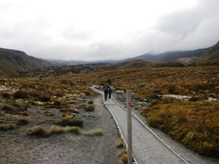
One highlight of the walk is tramping across a huge crater. Looking closely, you can make out the track. Way cool.


The edge of the red crater.


A glimpse of the Blue Lake on the way down to the Emerald Lakes. Acidic, but quite beautiful - like liquid jewels.


Looking back, at a lava flow.


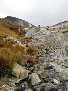
On the way down, we passed the runoff from a hot spring. Once again, it helped us to realize how vulnerable the terrain was over which we were walking.


One of the reasons that the Tongariro Crossing is regarded so highly is views like these on the way down.


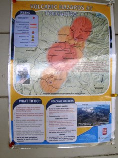
Why you hope that Ruapehu and the other more dormant volcanoes don't wake up while you're tramping or camping.